Hauser Lake Watershed Coalition Inc.
Caring Enough to Make A Difference
Hauser Lake History & Facts
This lake has not always been known as Hauser Lake. Old maps show that it was earlier known as Mud Lake, Mudd Lake and Sucker Lake. So who was Hauser and what was his connection to this area.
Sometime after the gold and silver strikes in North Idaho, the governor of Montana, Samuel T. Hauser, sent his good friend and business partner, Daniel Corbin, to North Idaho to look into building a railroad line into the Coeur d’Alene mining district. Corbin eventually built a branch line from the Northern Pacific Railroad, beginning at the area now known as Hauser Junction, into Post Falls and on to the steamboat docks in Coeur d’Alene. Completed in 1886, it was approximately 13.5 mile long and was called the Spokane Falls and Idaho Railroad.
It is therefore believed that Hauser Junction was named at the time the branch was completed by Daniel Corbin in honor of Governor Hauser. The lake north of Hauser Junction and the village at the lake were also subsequently named for Governor Hauser.
Excerpts for History of North Idaho, published in 1903 by the Western Historical Publishing Company, state:
Hauser is the junction of the main line with the Coeur d’Alene branch of the Northern Pacific Railroad. It is twenty-one miles east of Spokane and six miles southwest of Rathdrum, the county seat of Kootenai County. It is in the Spokane Valley, or what is termed locally, the Rathdrum Prairie, about midway between Mud Lake (now Hauser Lake) on the north and Spokane River on the south. The surrounding lands are largely agricultural and some of the best ranches in the county are in this vicinity. Its proximity to Post Falls, which is only about five miles away, has retarded progress at Hauser in the business way, but to the north and west is quite a large expanse of territory that must, when fully settled, become a tributary to the town. Consequently, there is reason to believe that in the future it will become a thriving village.
Settlements were made here as early as 1889, but in 1900 it was credited with a population of only 38…..
…The town is pleasantly situated, with the prairie stretching way to the east and west and the mountains rising on the north and south. There is an abundance of timberland to the north that is valuable, not only for the timber, but for its productive qualities when cleared. It is a desirable local for home builders. Adjoining lands on all sides are being rapidly settled.”
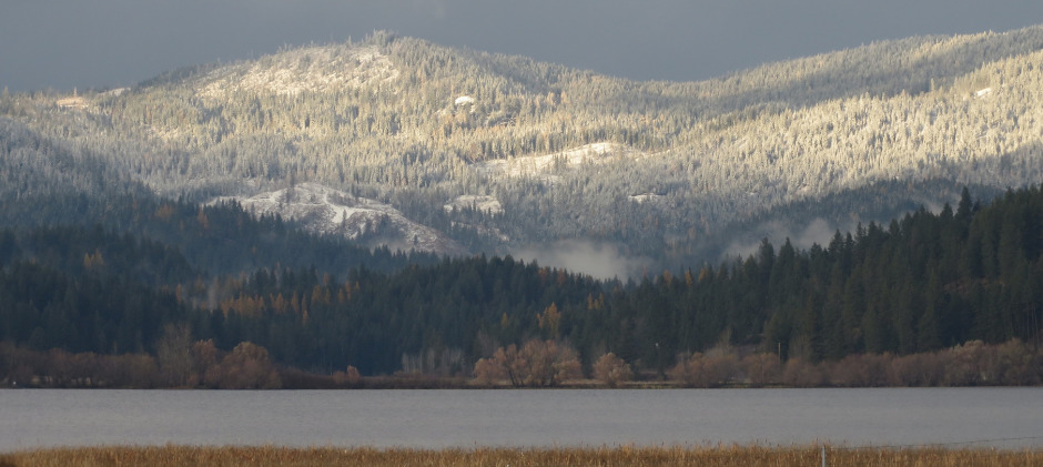
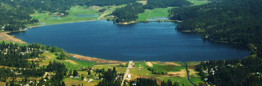
The Hauser Lake watershed area is still not completely developed and is much more of a “blue collar” lake than its neighboring lakes. Although development continues, it does so at a slower pace than during the 2 - 3 decades prior to the 2008 housing collapse. There is still timberland, farmland, and other natural, undeveloped land visible from the lake, above its western, northern and eastern shores.
|
Physical & Hydrological Characteristics |
|
|
Lake Surface |
625 acres |
|
Maximum Depth |
40 ft. |
|
Mean Depth |
21 ft. |
|
Lake Volume |
5.7 x 108 ft. |
|
Watershed Area |
12,9000 acres |
|
Surface Lake Elevation |
2,187 ft. |
|
Flushing Rate |
8 months |
|
Land Use Areas within the Hauser Lake Watershed |
||
|
Type |
Acres |
Percentage
|
|
Forest |
10,962 |
85% |
|
Agriculture |
775 |
6% |
|
Rural/Suburban |
659 |
5% |
|
Incorporated Suburban |
349 |
3% |
|
Wetlands |
155 |
1% |
|
Total |
12,9001 |
100% |
1 18% (2,350 acres) is located in Washington and 82% (10,550) is located in Idaho